

Table of Contents
Mobile GPS navigation and neighborhood safety application designed to help users avoid high-crime areas by generating safe routing options
Zone Technologies Inc.
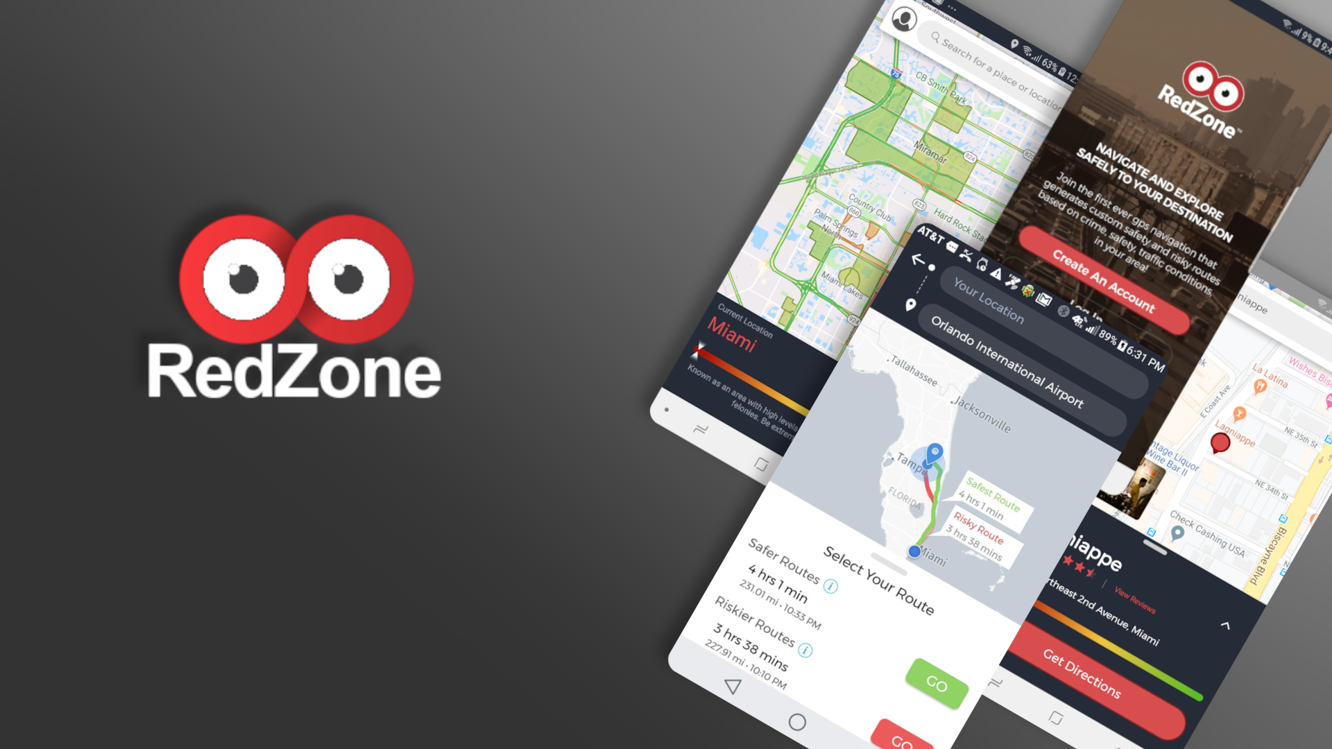
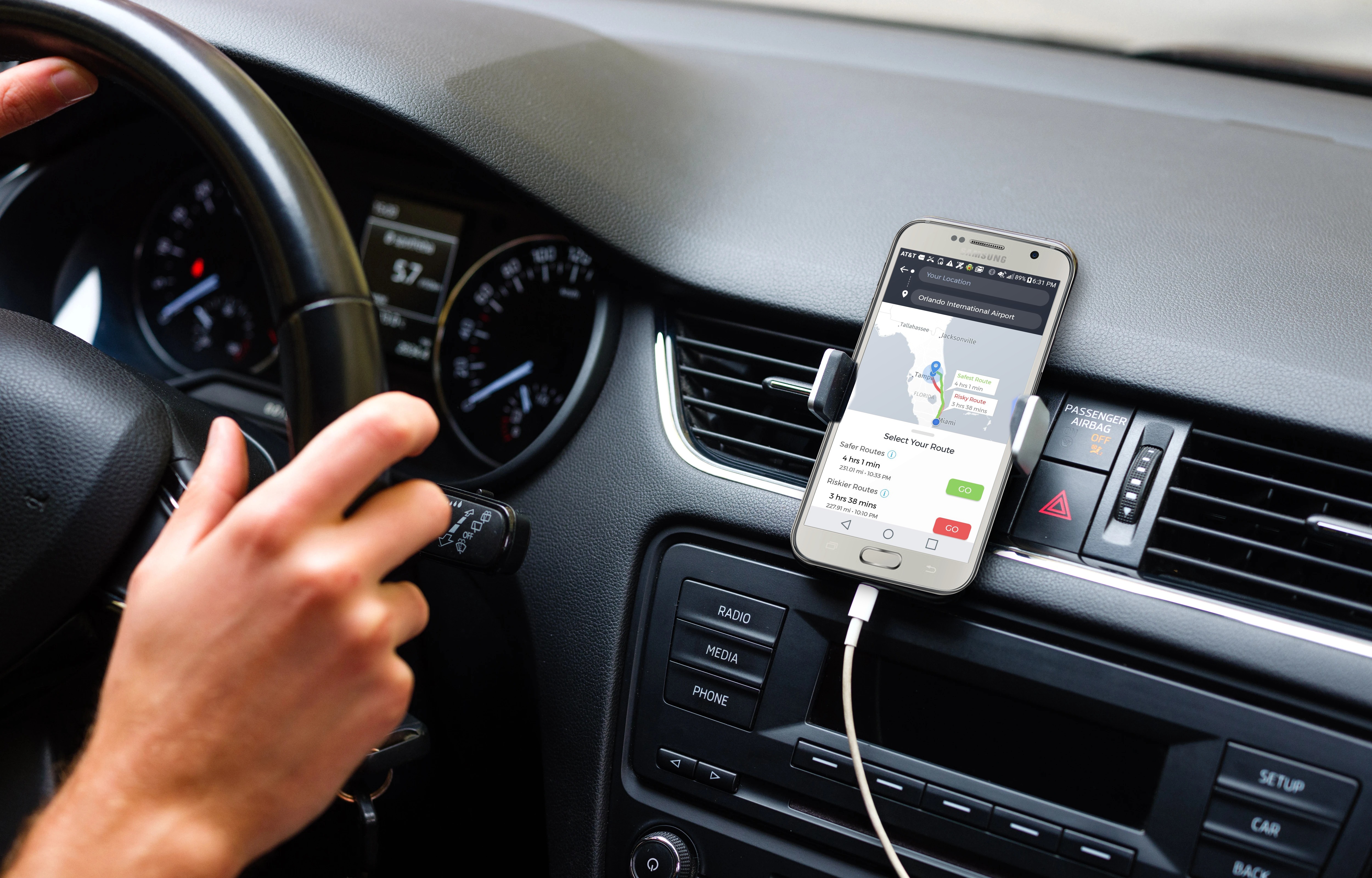
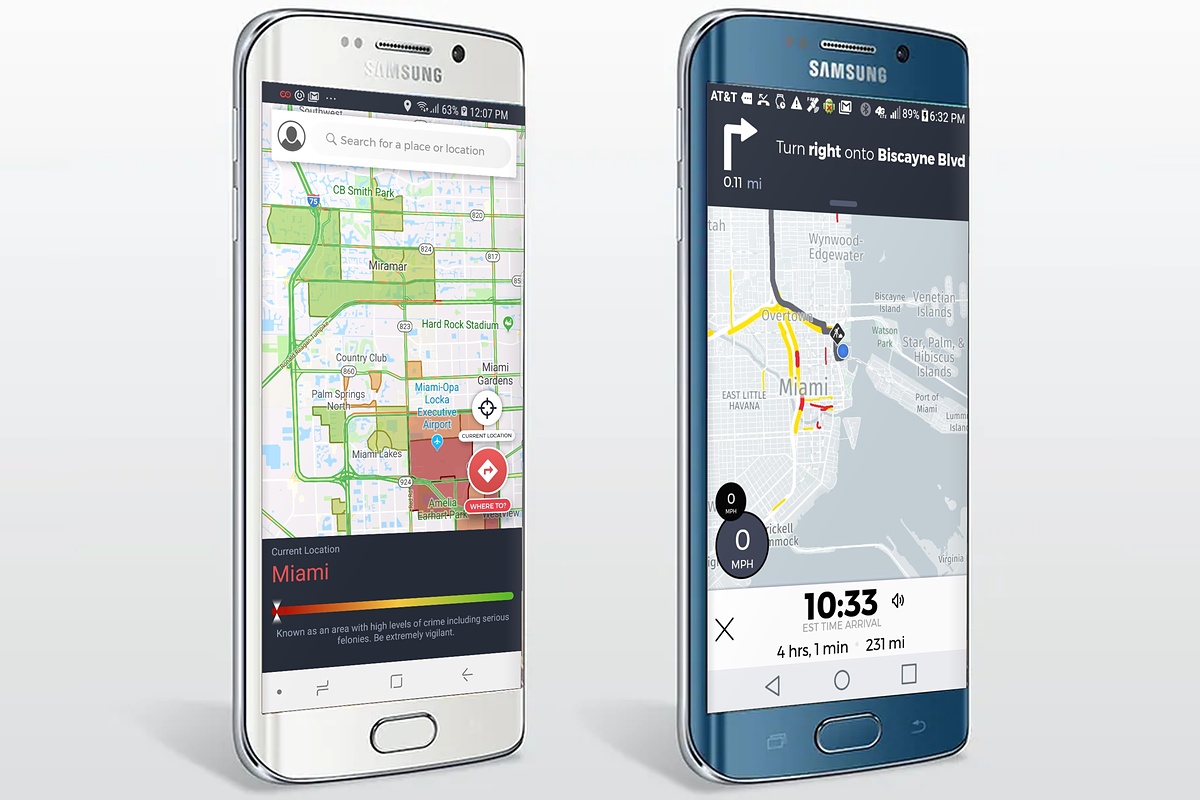
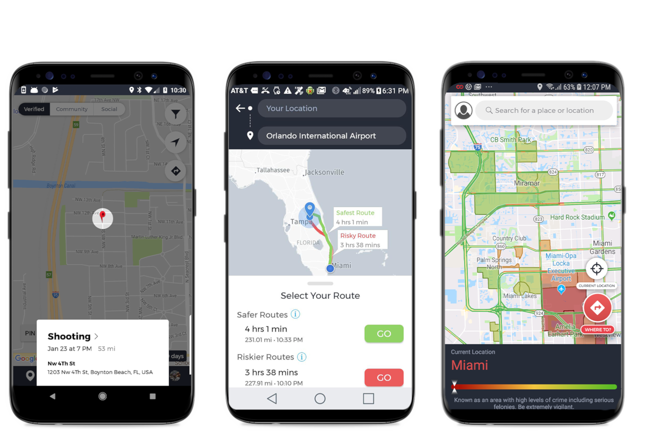
RedZone Map was the first GPS navigation app that generated safer routes by combining real-time and historical crime data from police/government sources with live community reports. Available across the US (and Israel in earlier versions), it let users choose between Safe and Risky routes while staying informed about nearby incidents.
Key features
- Dynamic generation of Safe vs. Risky routes based on crime data and user reports
- Place search with details, reviews, and zone-level safety scores
- Community reporting of suspicious activity, shootings, theft, assaults, vandalism, and police presence (with photo/video upload, likes, and comments)
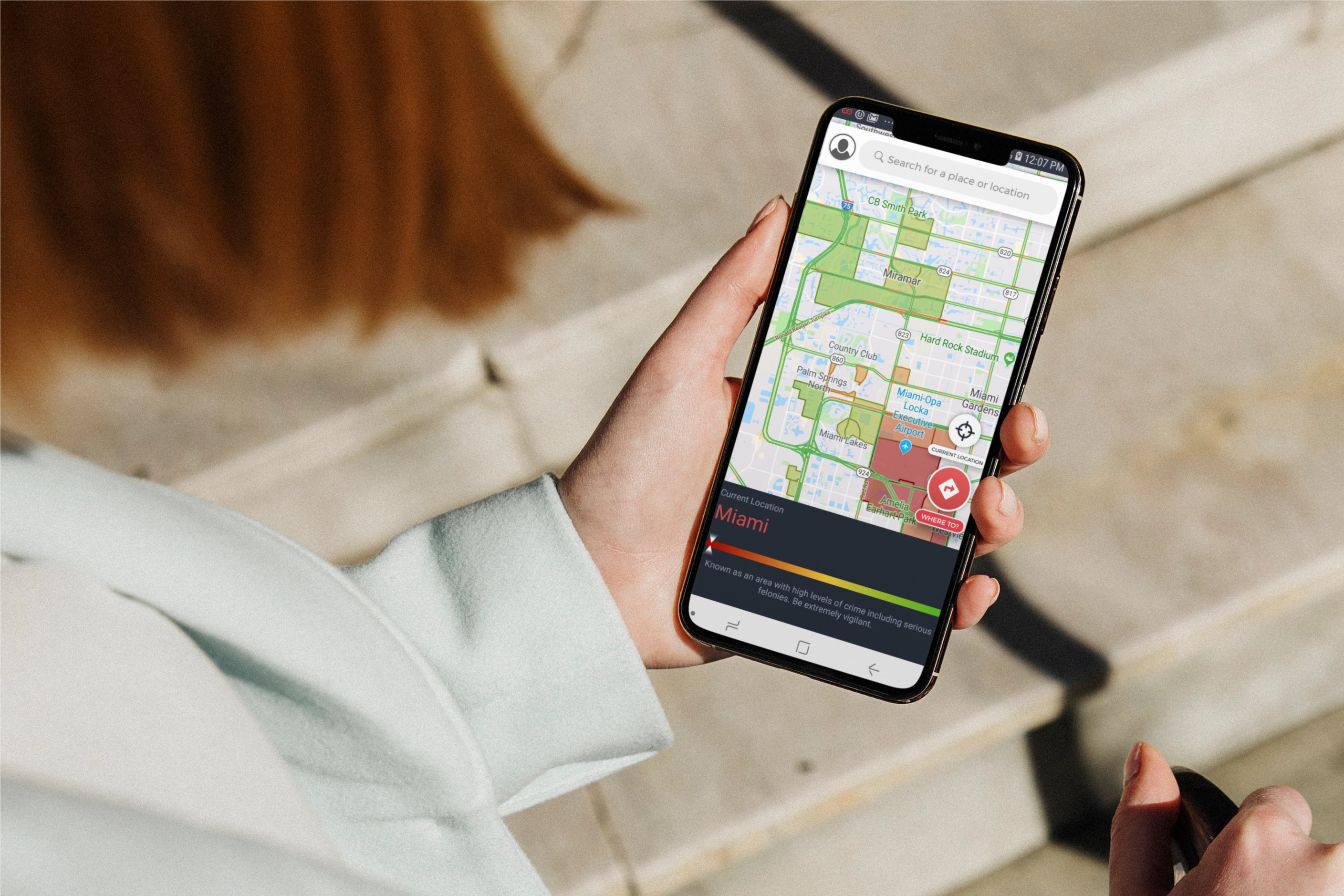
- Interactive map visualization of “Red Zones” (high-crime areas) and overall safety levels
- Speed-limit monitoring, traffic patterns, and voice-guided turn-by-turn directions
- Proximity alerts for nearby incidents and a safety meter for the current location
The app version supporting Android devices was developed on Android Studio using Java, Room, AWS. Was available for the US.
Technical challenges & solutions
This was my first map-based navigation project, so I had to deeply research and implement geospatial algorithms while working within strict API limits:
- Detected whether routes crossed high-risk (“Red Zone”) areas using GeoBounding Boxes, polylines/polygons, ray-casting, and angle-summation point-in-polygon tests
- Applied the Douglas-Peucker algorithm to simplify complex zone boundaries so they stayed under HERE’s coordinate limits (~40 points per banned area) and overall route waypoint limits (~128)
- Calculated travel bearing/orientation, southwest/northeast bounding boxes, and continuously optimized for battery usage during continuous location tracking
- Worked with OSRM for routing and handled real-time data synchronization with community reports
The result was a production Android app that turned multi-source crime and community data into practical, safer navigation for everyday travel.
You can have an overview of the old website in the Web Archive:
 Images credit: Anthony García
Play2Pay
XSales Mobility